 Florida Geological Survey Bulletin 31
Situated in water about 88 ft deep, this sink is 22.5 mi E. of Crescent Beach
Submarine Spring in the Atlantic Ocean. It is funnel shaped to a depth of about 150 ft,
vertical from that depth to 465 ft, and may be considerably deeper (Wilcove, 1975).
Previously reported to be a freshwater spring, none of the water samples collected
at a depth of 465 ft were fresh. Kohout and others (1975) suggest that Red Snapper
Sink may now be a point of seawater intrusion into the Floridan Aquifer. They cite the
high oxygen content of the water deep in the sink and a dye-dispersion test as indicators
of a slight downward velocity of seawater in the sink.
1997 USGS Hydrology Report
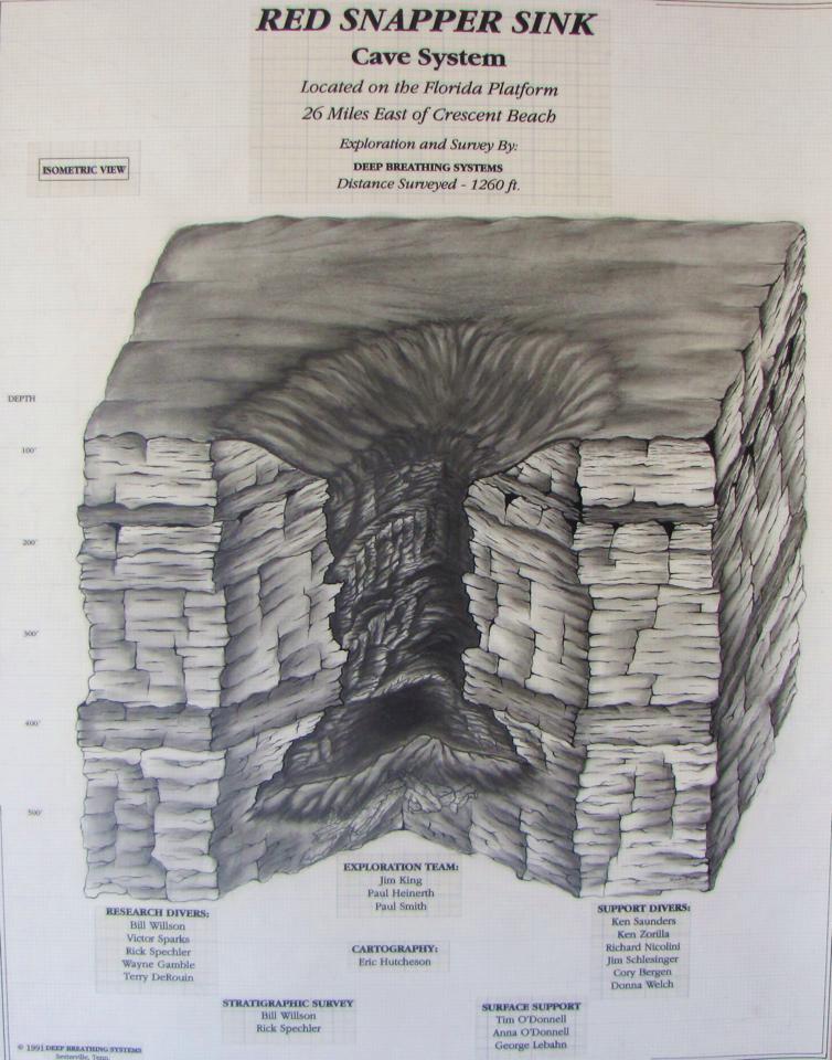
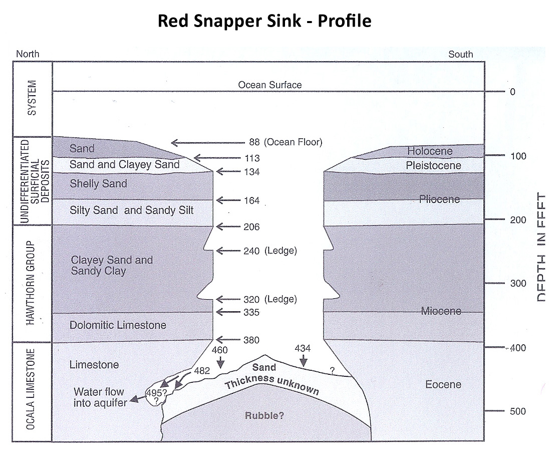
Red Snapper Sink is located on the continental shelf, about 26 miles east of
Crescent Beach, Florida. In 1991, advanced technical-diving techniques enabled
divers to explore the bottom of the sinkhole for the first time. The opening
of the sinkhole at a depth of 90 ft is approximately 400 ft in diameter. The
maximum recorded depth in the sinkhole is 482 ft. The sloping sides of the
sinkhole are developed on loose Holocene sand and shell from 88 to 113 ft.
Pleistocene sand and clayey sand crop out from 113 to 134 ft. From 134 ft
to about 380 ft, Red Snapper Sink is a vertical shaft measuring about 150 ft
in width to 170 ft in length. The walls of the shaft from 134 to 164 ft transect
slightly indurated Pliocene shelly sand. The walls are composed of moderately
indurated Pliocene silty sands and sandy silts from 164 to 206 ft. From 206 to
335 ft, the walls are developed in clayey sands and sandy clays of the Upper
Hawthorn Group (Miocene). The Lower Hawthorn consists of a dolomitic limestone
containing phosphate pebbles and carbonate interclasts with phosphatic rims
from 335 to 380 ft. The top of the Ocala Limestone occurs at 380 ft, and below
this depth, the walls of the shaft are undercut. Water samples collected at the
bottom show normal seawater specific conductance and chloride and sulfate
concentrations. During a dive to 482 ft, sea water was observed flowing into
small caves at the base of the wall, indicating that during the dive period,
the sinkhole conveyed saltwater into the Floridan aquifer system. Seismic
profiles show that Red Snapper Sink is the surficial expression of a dissolution
collapse feature that possibly originated in Upper Cretaceous or Paleocene rocks.
Similar buried features in northeastern Florida could provide a hydraulic
connection between freshwater zones and deeper, more saline zones of the Floridan
aquifer system. The presence of these collapse features could help explain the
anomalous distribution of elevated chloride concentrations in parts of eastern Duval
County.


