 Portions of the following information were taken from Florida Geological Survey Bulletin 66.
 Sun Springs is approximately 7.8 miles north of Fanning Springs within a private community and not accessible to the public by land. From the intersection US 98/19 and SR 26 in Fanning Springs travel north on SR 26 approximately 1.4 miles to the town of Wilcox. In Wilcox, SR 26 makes a 90 degree bend to the east (right). At this bend continue north (straight) onto CR 232 and travel approximately 6.2 miles to the intersection with SW 25th Street. Head west (left) on SW 25th Street and go approximately 0.8 mile to the boat ramp. The spring run flows into the Suwannee River from the east approximately 0.35 miles upstream from the boat ramp.
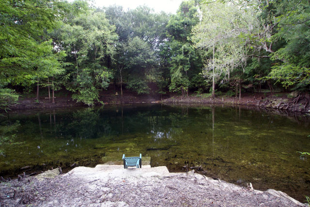
Description - Sun Springs is situated in a bowl-shaped depression. The spring pool measures 99 ft north to south and 132 ft east to west. Maximum depth of the pool measures 14.2 ft. There are two vents. The main vent, which was sampled for water quality, is roughly in the center. The other, smaller vent is situated on the south side of the pool upslope from the main vent. The bottom of the spring is sand with some limestone exposed near both vents. The water was clear with a greenish tint in April 2002. No boil was present on the water surface at this time, but there was noticeable current in the shallow spring run. There are concrete terraces along the east side of the pool. The spring has a fence around the southern portion near the dirt access road. The spring run averages about 15 ft wide and 2 ft deep. It flows north then west a total distance of approximately 1,900 ft. At the time of the visit, there was relatively little aquatic vegetation in the spring pool and run, but both harbored abundant algal mats. However, two months earlier, there was abundant Hydrilla and water lettuce (Follman, personal communication, 2004). High banks of the spring and run rise to approximately 15-18 ft above the water level. The surroundings consist of private residences and hardwood trees on the banks and some cypress trees along spring and run edges.
Utilization - The spring is developed into a private swimming area for local residents and is not open to the public. In April 2002, water levels in the spring run were too low to allow spring access through the run; however, access would be possible during higher water levels.


