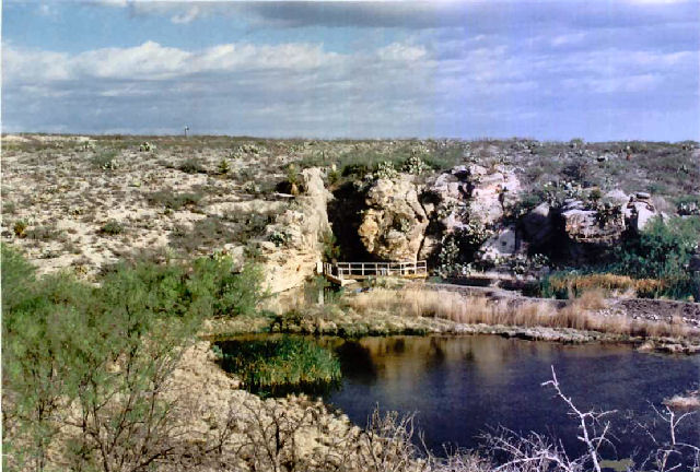
Phantom Lake Spring (sometimes Springs) is actually a group of springs that pour from a cavern at the foot of a lower Cretaceous limestone bluff four miles west of Toyahvale in northeastern Jeff Davis County. The area surrounding the springs is mostly rugged with high relief. The local shallow, stony soils support a wide variety of scrub brush, cacti, and grasses. The springs were a favorite campground of prehistoric people, who probably used the water to irrigate crops. In 1583 Antonio de Espejo may have been the first white man to see the springs, but in the mid-1850s they were rediscovered by white explorers, who named the site Phantom Lake because several of them were later unable to find it again. A map from the 1880s called the springs Ojo la Loma. The springs actually rise in a wet cave, in which several people have died; the entrance to the cave is now closed with a barred gate. The four-mile Phantom Lake Canal, built in the 1940s, carries water from the springs to Toyahvale for irrigation. Irrigation wells to the southwest caused the spring flow to decline from 450 liters per second in 1932 to 140 in 1976. In the early 1980s the Comanche Springs pupfish and several rare invertebrate animals still lived at these springs.


