 Portions of the following information were taken from Florida Geological Survey Bulletin 66.
Wakulla Spring is located in Wakulla Springs State Park about 20 miles south of Tallahassee.
From the US 319 (Thomasville Road) exit on I-10 take Capital Circle (US 319) south 12.9 miles.
Turn south (right) on US 319/SR 61 (Crawfordville Highway) and travel 1.9 miles. Bear left on
SR 61 (Wakulla Springs Road) and go 7.6 miles to SR 267. Turn east (left) and park entrance is
0.1 miles on the south side of the road. The spring vent is located below the diving platform,
northeast of the parking area.
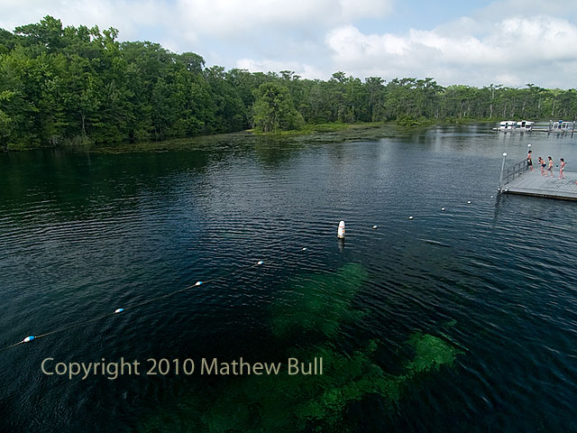
Description - Wakulla Spring is one of the largest and most dramatic of Floridas springs. The spring pool is
roughly circular with a diameter of 315 ft north to south. The maximum pool depth is 185 ft. The
vent opening is a horizontal ellipse along the south side of the pool bottom and is estimated to
measure 50 ft by 82 ft. Along with a few smaller springs nearby, including Sally Ward Spring,
Wakulla Spring gives rise to the clear Wakulla River. Water clarity of the spring in October 2001
was exceptional and the water was light blue. It should be noted that the water clarity of the
spring varies dramatically in response to rainfall. Surface water entering the sinkholes that connect
to the Wakulla Spring system greatly reduces the clarity. Exotic aquatic vegetation once covered
much of the spring pool and adjacent river bottom, but divers have recently removed large amounts
and herbicides have been used in efforts to control it. The Wakulla River remains choked with exotic
invasive plants. Many other aquatic and emergent plant species also are present in the spring pool
and river. A mixed hardwood, cabbage palm, and cypress forest inhabits lowlands along the north and
east shores of the spring and along the river. Uplands along the western shore of the spring are
developed into a state park lodge and facilities. Also, there are hardwoods and large loblolly pines
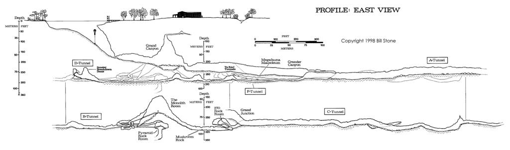
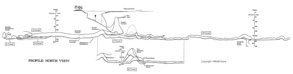
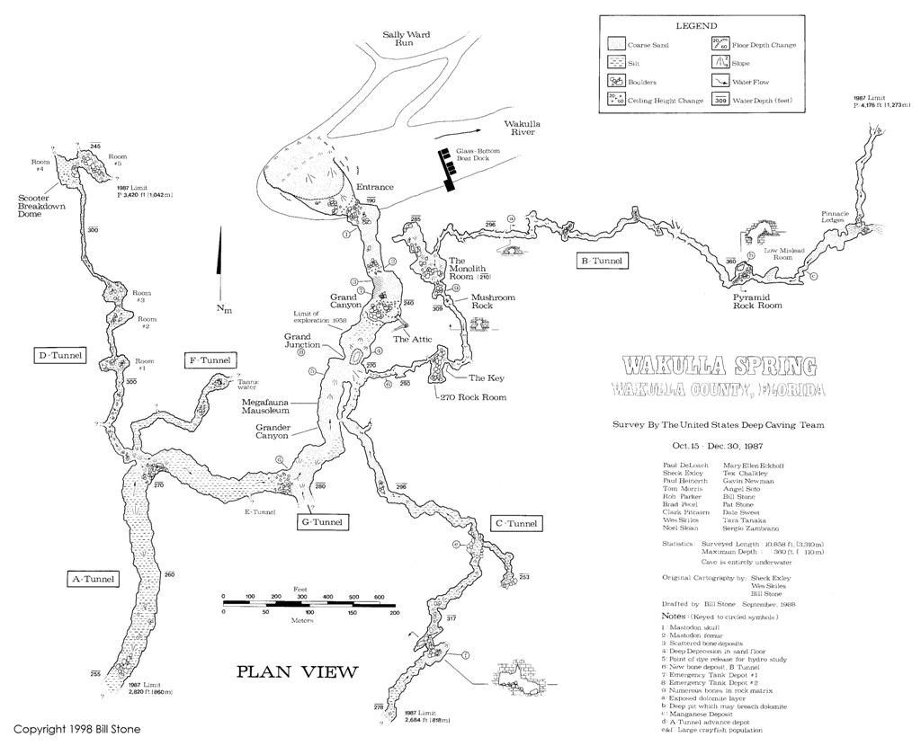
scattered about. A major underwater cave system has been mapped at Wakulla Springs.
Utilization - Wakulla Spring is developed into a recreational and wildlife viewing area. The park has a lodge
and restaurant. There are regular glass-bottomed riverboat and spring tours, and swimming is
allowed in the southeast quadrant of the spring pool. The upper 3 miles of the Wakulla River
is state-owned and is a protected wildlife sanctuary.


