 Portions of the following information were taken from Florida Geological Survey Bulletin 66.
Mearson Springs are located approximately 9 miles east of Mayo along the southwest bank of the
Suwannee River. From the intersection of US 27 and SR 51 in Mayo, head east on US 27 for
approximately 6.6 miles to the intersection with CR 251. Turn east (left) onto CR 251 and
drive approximately 2 miles until the road makes a 90 degree bend to the north. Continue north
on CR 251 approximately 0.7 miles to a boat landing at the end of the road. The spring are
0.8 miles downstream from the boat ramp on SR 251. Mearson Springs occupy a southwest to
northeast-trending cove surrounded by high banks along the southwest bank of the Suwannee River.
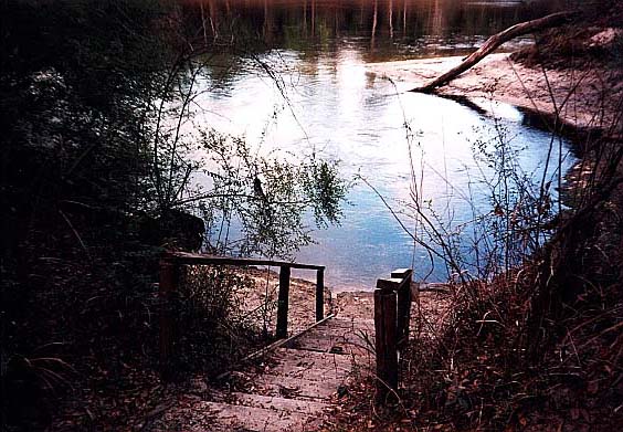
Description - Mearson Springs pool, which has three vents, measures 75 ft southwest to
northeast and 51 ft southeast to northwest. The largest spring vent is southernmost, where a
cavern opens beneath a limestone shelf. The depth over the largest spring measures 11.8 ft. The
bottom is limestone and varying amounts of sand. Spring water is clear and slightly green,
contrasting with the dark water of the Suwannee River. There are thick patches of algae but
little to no other aquatic vegetation. Three springs producing prominent boils are oriented
linearly along a 30 ft long, north-south trending limestone fissure. On the southwest side,
a wooden boardwalk and stairs lead down into the spring from the 15 to 25 ft high banks. The
short spring run discharges northeast about 30 ft into the river. Land around the spring is
privately owned and forested adjacent to the spring. Spring discharge is dictated by
Suwannee River stage. Bare limestone and sand banks that are typically underwater were exposed
during the April 2002 visit due to extremely low river levels. The adjacent riverbanks are
composed of scalloped limestone, shell marl, and sand.
Utilization - The spring is surrounded by private land and is used locally for swimming.


